Kula, Hawaii Map and Directory
Regional Directory > States Menu > Hawaii
 According to the United States Census Bureau, Kula is a Census-designated Place that is located in Maui County, Hawaii at 20.77 degrees North and 156.33 degrees West.
The place's time zone is Pacific/Honolulu, and the place's primary telephone area code is 808.
The land area of Kula is about 34.61 square miles, whereas the water area of the place is about 0.00 square miles.
Maui County's land area is about 1,162 square miles, so the place occupies about 3.0 percent of the county's total land area.
According to the United States Census Bureau, Kula is a Census-designated Place that is located in Maui County, Hawaii at 20.77 degrees North and 156.33 degrees West.
The place's time zone is Pacific/Honolulu, and the place's primary telephone area code is 808.
The land area of Kula is about 34.61 square miles, whereas the water area of the place is about 0.00 square miles.
Maui County's land area is about 1,162 square miles, so the place occupies about 3.0 percent of the county's total land area.
The Census Bureau estimates that Kula had about 7,621 residents in 2019, which is approximately 220 people per square mile of land area.
According to recent American Community Survey data, the median household income in Kula was about $76,509 per year.
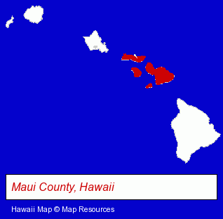
The Hawaii counties map at upper right shows Maui County, highlighted in red. Use the menu below to display interactive maps of Kula, either in a frame on this page or in full-screen mode.
Use the menu below to display categorized Kula directories.
| Kula Directory Page: | Visual Arts |
|---|
Selected Kula, Hawaii Listings
These Kula listings in zipcode 96790 provide a window into the place's cultural environment and economic climate. Kingswood Shop- Home Furnishings Stores
- Furniture Stores
- Florists
- Pet Care Services
- Pet Grooming & Boarding
- Kennels
Nearby Hawaii Cities and Towns *
- Hana (1) - Hana, Hawaii information and maps.
- Honolulu (68) - Honolulu, Hawaii products & services directory.
- Kahului (3) - Kahului, Hawaii information and maps.
- Kihei (8) - Kihei, Hawaii demographics and maps.
- Lahaina (9) - Lahaina, Hawaii demographics and directory.
- Makawao (1) - Makawao, Hawaii information and maps.
- Wailuku (2) - Wailuku, Hawaii information and maps.
* Parenthesized numbers indicate economic activity levels.
Copyright © 2011-2026 RegionalDirectory.us. All rights reserved.