Kailua, Hawaii Map and Directory
Regional Directory > States Menu > Hawaii
 According to the United States Census Bureau, Kailua is a Census-designated Place that is located in Honolulu County, Hawaii at 21.40 degrees North and 157.74 degrees West.
The place's time zone is Pacific/Honolulu, and the place's primary telephone area code is 808.
The land area of Kailua is about 7.75 square miles, whereas the water area of the place is about 2.82 square miles.
Honolulu County's land area is about 601 square miles, so the place occupies about 1.3 percent of the county's total land area.
According to the United States Census Bureau, Kailua is a Census-designated Place that is located in Honolulu County, Hawaii at 21.40 degrees North and 157.74 degrees West.
The place's time zone is Pacific/Honolulu, and the place's primary telephone area code is 808.
The land area of Kailua is about 7.75 square miles, whereas the water area of the place is about 2.82 square miles.
Honolulu County's land area is about 601 square miles, so the place occupies about 1.3 percent of the county's total land area.
The Census Bureau estimates that Kailua had about 37,586 residents in 2019, which is approximately 4,850 people per square mile of land area.
According to recent American Community Survey data, the median household income in Kailua was about $114,292 per year.
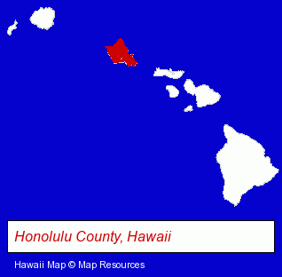
The Hawaii counties map at upper right shows Honolulu County, highlighted in red. Use the menu below to display interactive maps of Kailua, either in a frame on this page or in full-screen mode.
Use the menu below to display categorized Kailua directories.
| Kailua Products and Services Directory | |
|---|---|
| Clothing Stores | Home Improvement |
Selected Kailua, Hawaii Listings
These representative Kailua listings provide some insight into the place's cultural environment and economic climate.- Chiropractors
- Chiropractic Information & Referral Services
- Clothing & Accessories Retail
- Visual Arts
- Photography
- Clinics & Medical Centers
- Veterinarians
- Animal Hospitals
- Animal Health
- Other Schools & Instruction
- Performing Arts Schools
- Music Instruction
- Music
- Instrumental Music Instruction
- Building & Home Construction
- Engineers
- Architects
- Architectural Services
- Engineering Services
- Sportswear Retail
- Water Sports Equipment & Supplies Dealers
- Swimwear Retail
- Financial Services
- Collection Agencies
- Charitable & Nonprofit Organizations
- Private Golf Courses
- Private Golf Clubs
- Accountants
- Public Accountants
- Certified Public Accountants
- Financial Services
- Advertising
- Advertising & Promotional Product Dealers
- Advertising Specialties Wholesale & Manufacturers
- Advertising & Promotional Gifts
- Dentists
Nearby Hawaii Cities and Towns *
- Haleiwa (1) - Haleiwa, Hawaii information and maps.
- Honolulu (68) - Honolulu, Hawaii products & services directory.
- Kihei (8) - Kihei, Hawaii demographics and maps.
- Lahaina (9) - Lahaina, Hawaii demographics and directory.
- Waipahu (1) - Waipahu, Hawaii information and maps.
* Parenthesized numbers indicate economic activity levels.
Copyright © 2011-2026 RegionalDirectory.us. All rights reserved.