Greencastle, Indiana Map and Directory
Regional Directory > States Menu > Indiana
 According to the United States Census Bureau, Greencastle is a City that is located in Putnam County, Indiana at 39.64 degrees North and 86.86 degrees West.
The city's time zone is America/Indiana/Indianapolis, and the city's primary telephone area code is 765.
The land area of Greencastle is about 5.24 square miles, whereas the water area of the city is about 0.05 square miles.
Putnam County's land area is about 481 square miles, so the city occupies about 1.1 percent of the county's total land area.
According to the United States Census Bureau, Greencastle is a City that is located in Putnam County, Indiana at 39.64 degrees North and 86.86 degrees West.
The city's time zone is America/Indiana/Indianapolis, and the city's primary telephone area code is 765.
The land area of Greencastle is about 5.24 square miles, whereas the water area of the city is about 0.05 square miles.
Putnam County's land area is about 481 square miles, so the city occupies about 1.1 percent of the county's total land area.
The Census Bureau estimates that Greencastle had about 10,270 residents in 2019, which is approximately 1,960 people per square mile of land area.
According to recent American Community Survey data, the median household income in Greencastle was about $47,471 per year.
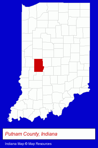
The Indiana counties map at upper right shows Putnam County, highlighted in red. Use the menu below to display interactive maps of Greencastle, either in a frame on this page or in full-screen mode.
Use the menu below to display categorized Greencastle directories.
| Greencastle Products and Services Directory | |
|---|---|
| Building Materials | Schools |
Selected Greencastle, Indiana Listings
These representative Greencastle listings provide some insight into the city's cultural environment and economic climate.- Information Technology Services
- Internet Products & Services
- Internet Services
- Internet Service Providers
- Printing & Publishing
- Publishers
- Newspaper Publishers
- Newspaper Feature Syndicates
- Newspaper Distributors
- Auto Parts Wholesale & Manufacturers
- Truck Equipment, Parts & Accessories Retail
- Truck Parts & Equipment Wholesale & Manufacturers
- Colleges & Universities
- Loan & Financing Services
- Door & Window Dealers
- Home Improvement & Maintenance
- Building Materials & Supplies Dealers
- Plumbing Contractors
- Home Improvement Stores
- Hardware Dealers
- Medical Equipment & Supplies Retail
- Audio Equipment & Supplies Dealers
- Music Stores
Nearby Indiana Cities and Towns *
- Bloomington (17) - Bloomington, Indiana solutions directory and maps.
- Carmel (14) - Carmel, Indiana demographics and directory.
- Greenwood (6) - Greenwood, Indiana demographics and maps.
- Indianapolis (110) - Indianapolis, Indiana products & services directory.
- Lafayette (12) - Lafayette, Indiana demographics and directory.
- Terre Haute (8) - Terre Haute, Indiana demographics and maps.
- Zionsville (2) - Zionsville, Indiana information and maps.
* Parenthesized numbers indicate economic activity levels.
Copyright © 2011-2026 RegionalDirectory.us. All rights reserved.