Hopkinsville, Kentucky Map and Directory
Regional Directory > States Menu > Kentucky
 According to the United States Census Bureau, Hopkinsville is a City that is located in Christian County, Kentucky at 36.87 degrees North and 87.49 degrees West.
The city's time zone is America/Chicago, and the city's primary telephone area code is 364.
The land area of Hopkinsville is about 31.12 square miles, whereas the water area of the city is about 0.14 square miles.
Christian County's land area is about 718 square miles, so the city occupies about 4.3 percent of the county's total land area.
According to the United States Census Bureau, Hopkinsville is a City that is located in Christian County, Kentucky at 36.87 degrees North and 87.49 degrees West.
The city's time zone is America/Chicago, and the city's primary telephone area code is 364.
The land area of Hopkinsville is about 31.12 square miles, whereas the water area of the city is about 0.14 square miles.
Christian County's land area is about 718 square miles, so the city occupies about 4.3 percent of the county's total land area.
The Census Bureau estimates that Hopkinsville had about 30,680 residents in 2019, which is approximately 986 people per square mile of land area.
According to recent American Community Survey data, the median household income in Hopkinsville was about $41,597 per year.
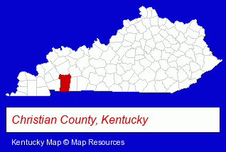
The Kentucky counties map at upper right shows Christian County, highlighted in red. Use the menu below to display interactive maps of Hopkinsville, either in a frame on this page or in full-screen mode.
Use the menu below to display categorized Hopkinsville directories.
| Hopkinsville Directory Page: | Schools |
|---|
Selected Hopkinsville, Kentucky Listings
These Hopkinsville listings provide some insight into the city's cultural environment and economic climate.- Building Materials & Supplies Wholesale & Manufacturers
- Accountants
- Public Accountants
- Certified Public Accountants
- Clinics & Medical Centers
- Clinics
- Family Planning & Birth Control Clinics
- Auto Parts Retail
- Industrial Equipment Rebuilding, Service & Repair
- Civic Clubs & Organizations
- Public Golf Courses
- Sports & Recreation Clubs & Organizations
- Country Clubs
- Pet Care Services
- Pet Sitting & Day Care
- Home Improvement & Maintenance
- Building Materials & Supplies Dealers
- Home Improvement Stores
- Commercial & Industrial Building Materials & Supplies
- Lumber Dealers
- Elementary & Secondary Education
- Elementary Schools
- Banks
- Advertising
- Radio Stations
- Advertising Production Services
- Television & Radio Advertising Production
Nearby Kentucky Cities and Towns *
- Bowling Green (11) - Bowling Green, Kentucky demographics and directory.
- Henderson (1) - Henderson, Kentucky information and maps.
- Louisville (92) - Louisville, Kentucky products & services directory.
- Mayfield (2) - Mayfield, Kentucky information and maps.
- Murray (2) - Murray, Kentucky information and maps.
- Owensboro (6) - Owensboro, Kentucky demographics and maps.
- Paducah (12) - Paducah, Kentucky demographics and directory.
Large and Mid-size Cities in Nearby States
- Clarksville, Tennessee (22) - Clarksville, TN demographics and directory.
* Parenthesized numbers indicate economic activity levels.
Copyright © 2011-2026 RegionalDirectory.us. All rights reserved.