Chicopee, Massachusetts Map and Directory
Regional Directory > States Menu > Massachusetts
 According to the United States Census Bureau, Chicopee is a City that is located in Hampden County, Massachusetts at 42.15 degrees North and 72.61 degrees West.
The city's time zone is America/New York, and the city's primary telephone area code is 413.
The land area of Chicopee is about 22.83 square miles, whereas the water area of the city is about 1.04 square miles.
Hampden County's land area is about 617 square miles, so the city occupies about 3.7 percent of the county's total land area.
According to the United States Census Bureau, Chicopee is a City that is located in Hampden County, Massachusetts at 42.15 degrees North and 72.61 degrees West.
The city's time zone is America/New York, and the city's primary telephone area code is 413.
The land area of Chicopee is about 22.83 square miles, whereas the water area of the city is about 1.04 square miles.
Hampden County's land area is about 617 square miles, so the city occupies about 3.7 percent of the county's total land area.
The Census Bureau estimates that Chicopee had about 55,126 residents in 2019, which is approximately 2,415 people per square mile of land area.
According to recent American Community Survey data, the median household income in Chicopee was about $53,225 per year.
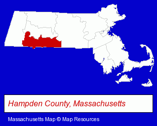
The Massachusetts counties map at upper right shows Hampden County, highlighted in red. Use the menu below to display interactive maps of Chicopee, either in a frame on this page or in full-screen mode.
Use the menu below to display categorized Chicopee directories.
| Chicopee Products and Services Directory | |
|---|---|
| Dentists | Insurance |
Selected Chicopee, Massachusetts Listings
These representative Chicopee listings provide some insight into the city's cultural environment and economic climate.- Printing & Publishing
- Printing Services
- Commercial Printing
- Chiropractors
- Business Management Services
- Libraries
- Public Libraries
- Grocery Stores & Supermarkets
- Fruits & Vegetables
- Attorneys
- Metals
- Metal Finishing
- Metals
- Metal Finishing
- Metal Polishing, Buffing & Plating
- Government Contractors
- Chemicals Wholesale & Manufacturers
- Chemicals - Manufacturers
- Airports
Nearby Massachusetts Cities and Towns *
- East Longmeadow (1) - East Longmeadow, Massachusetts information and maps.
- Hadley (2) - Hadley, Massachusetts information and maps.
- Holyoke (4) - Holyoke, Massachusetts information and maps.
- Northampton (8) - Northampton, Massachusetts demographics and maps.
- South Hadley (2) - South Hadley, Massachusetts information and maps.
- Springfield (18) - Springfield, Massachusetts solutions directory and maps.
- Westfield (5) - Westfield, Massachusetts demographics and maps.
* Parenthesized numbers indicate economic activity levels.
Copyright © 2011-2026 RegionalDirectory.us. All rights reserved.