South Hadley, Massachusetts Map and Directory
Regional Directory > States Menu > Massachusetts
 According to the United States Census Bureau, South Hadley is a Town that is located in Hampshire County, Massachusetts at 42.26 degrees North and 72.58 degrees West.
The town's time zone is America/New York, and the town's primary telephone area code is 413.
The land area of South Hadley is about 17.71 square miles, whereas the water area of the town is about 0.68 square miles.
Hampshire County's land area is about 527 square miles, so the town occupies about 3.4 percent of the county's total land area.
According to the United States Census Bureau, South Hadley is a Town that is located in Hampshire County, Massachusetts at 42.26 degrees North and 72.58 degrees West.
The town's time zone is America/New York, and the town's primary telephone area code is 413.
The land area of South Hadley is about 17.71 square miles, whereas the water area of the town is about 0.68 square miles.
Hampshire County's land area is about 527 square miles, so the town occupies about 3.4 percent of the county's total land area.
The Census Bureau estimates that South Hadley had about 17,703 residents in 2019, which is approximately 1,000 people per square mile of land area.
According to recent American Community Survey data, the median household income in South Hadley was about $69,346 per year.
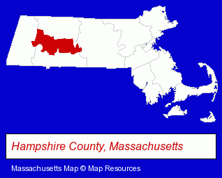
The Massachusetts counties map at upper right shows Hampshire County, highlighted in red. Use the menu below to display interactive maps of South Hadley, either in a frame on this page or in full-screen mode.
Use the menu below to display categorized South Hadley directories.
| South Hadley Products and Services Directory | |
|---|---|
| Building Contractors | Home Improvement |
Selected South Hadley, Massachusetts Listings
These representative South Hadley listings provide some insight into the town's cultural environment and economic climate.- Building & Home Construction
- Builders & Contractors
- Building Remodeling & Repair Contractors
- Metal Buildings Dealers
- Metal Building Contractors
- Pizza Restaurants
- Landscape Contractors
- Architects
- Architectural Designers
- Landscape Lighting
- Insurance
- Sports & Recreation Facilities
- Health Clubs & Gyms
- Builders & Contractors
- Building Contractors
- Government Contractors
- Financial Services
- Financing
- Dentists
- Orthodontics Dentists
- Exercise & Fitness Classes & Instruction
- Gymnastics Instruction
Nearby Massachusetts Cities and Towns *
- Amherst (9) - Amherst, Massachusetts demographics and directory.
- Chicopee (2) - Chicopee, Massachusetts information and maps.
- Hadley (2) - Hadley, Massachusetts information and maps.
- Holyoke (4) - Holyoke, Massachusetts information and maps.
- Northampton (8) - Northampton, Massachusetts demographics and maps.
- Springfield (18) - Springfield, Massachusetts solutions directory and maps.
- Westfield (5) - Westfield, Massachusetts demographics and maps.
* Parenthesized numbers indicate economic activity levels.
Copyright © 2011-2026 RegionalDirectory.us. All rights reserved.