Sudbury, Massachusetts Map and Directory
Regional Directory > States Menu > Massachusetts
 According to the United States Census Bureau, Sudbury is a Town that is located in Middlesex County, Massachusetts at 42.38 degrees North and 71.42 degrees West.
The town's time zone is America/New York, and the town's primary telephone area code is 351.
The land area of Sudbury is about 24.27 square miles, whereas the water area of the town is about 0.48 square miles.
Middlesex County's land area is about 818 square miles, so the town occupies about 3.0 percent of the county's total land area.
According to the United States Census Bureau, Sudbury is a Town that is located in Middlesex County, Massachusetts at 42.38 degrees North and 71.42 degrees West.
The town's time zone is America/New York, and the town's primary telephone area code is 351.
The land area of Sudbury is about 24.27 square miles, whereas the water area of the town is about 0.48 square miles.
Middlesex County's land area is about 818 square miles, so the town occupies about 3.0 percent of the county's total land area.
The Census Bureau estimates that Sudbury had about 19,122 residents in 2019, which is approximately 788 people per square mile of land area.
According to recent American Community Survey data, the median household income in Sudbury was about $191,310 per year.
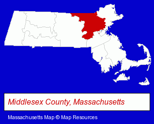
The Massachusetts counties map at upper right shows Middlesex County, highlighted in red. Use the menu below to display interactive maps of Sudbury, either in a frame on this page or in full-screen mode.
Use the menu below to display categorized Sudbury directories.
| Sudbury Products and Services Directory | ||
|---|---|---|
| Attorneys | Building Materials | Dentists |
| Health Clubs and Gyms | Home Improvement | Landscape Contractors |
| Restaurants | ||
Selected Sudbury, Massachusetts Listings
These randomly selected Sudbury listings provide some insight into the town's cultural environment and economic climate.- Churches
- Church & Religious Associations & Organizations
- Synagogues & Temples
- Printing & Publishing
- Publishers
- Vocational Education
- Business Education
- Estate Planning & Administration Attorneys
- Trial Attorneys
- Construction Law Attorneys
- Nurseries
- Greenhouses
- Auto Dealers
- Contact Lenses
- Opticians
- Architects
- Landscape Architects
- Auto Parts Wholesale & Manufacturers
- Beverages Retail
- Parking
- Parking Facilities
- Parking Garages
- Parking Facility Equipment & Supplies
- Alternative Medicine
- Chiropractors
- Alternative Medicine Practitioners
- Certified & Registered Massage Therapists
- Licensed Massage Therapists
- Visual Arts
- Photography
- Professional Photographers
Nearby Massachusetts Cities and Towns *
- Acton (7) - Acton, Massachusetts demographics and maps.
- Concord (10) - Concord, Massachusetts demographics and directory.
- Framingham (19) - Framingham, Massachusetts solutions directory and maps.
- Marlborough (17) - Marlborough, Massachusetts solutions directory and maps.
- Natick (11) - Natick, Massachusetts demographics and directory.
- Wayland (4) - Wayland, Massachusetts information and maps.
- Wellesley (6) - Wellesley, Massachusetts demographics and maps.
Large and Mid-size Cities in Nearby States
- Nashua, New Hampshire (20) - Nashua, NH demographics and directory.
* Parenthesized numbers indicate economic activity levels.
Copyright © 2011-2026 RegionalDirectory.us. All rights reserved.