Southborough, Massachusetts Map and Directory
Regional Directory > States Menu > Massachusetts
 According to the United States Census Bureau, Southborough is a Town that is located in Worcester County, Massachusetts at 42.30 degrees North and 71.53 degrees West.
The town's time zone is America/New York, and the town's primary telephone area code is 774.
The land area of Southborough is about 14.02 square miles, whereas the water area of the town is about 1.51 square miles.
Worcester County's land area is about 1,511 square miles, so the town occupies about 0.9 percent of the county's total land area.
According to the United States Census Bureau, Southborough is a Town that is located in Worcester County, Massachusetts at 42.30 degrees North and 71.53 degrees West.
The town's time zone is America/New York, and the town's primary telephone area code is 774.
The land area of Southborough is about 14.02 square miles, whereas the water area of the town is about 1.51 square miles.
Worcester County's land area is about 1,511 square miles, so the town occupies about 0.9 percent of the county's total land area.
The Census Bureau estimates that Southborough had about 10,121 residents in 2019, which is approximately 722 people per square mile of land area.
According to recent American Community Survey data, the median household income in Southborough was about $146,554 per year.
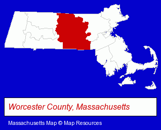
The Massachusetts counties map at upper right shows Worcester County, highlighted in red. Use the menu below to display interactive maps of Southborough, either in a frame on this page or in full-screen mode.
Use the menu below to display categorized Southborough directories.
| Southborough Directory Page: | Home Improvement |
|---|
Selected Southborough, Massachusetts Listings
These Southborough listings provide some insight into the town's cultural environment and economic climate.- Business Consultants & Advisors
- Advertising
- Advertising Agencies & Consultants
- Advertising & Design Agencies
- Adoption Agencies & Services
- Auto Service & Repair
- Importers
- Vocational Education
- Builders & Contractors
- Building Contractors
- Landscape Contractors
- Florists
- Gift Shops
- Garden Centers
- Wedding Flowers
- Attorneys
- Auto Service & Repair
- Industrial Equipment Rebuilding, Service & Repair
- Auto Machine Shop Services
- Auto Engine Service & Repair
- Banks
- Hobbies
- Metal Detectors
- Attorneys
- Management Consultants
- Fuel Oil Wholesalers
- Landscape Contractors
- Florists
- Lawn & Garden Equipment & Supplies Retail
- Garden Centers
- Dentists
- Libraries
- Towing
- Italian Restaurants
- Wine Bars
- Builders & Contractors
- Building Contractors
- Home Builders & Developers
Nearby Massachusetts Cities and Towns *
- Framingham (19) - Framingham, Massachusetts solutions directory and maps.
- Holliston (3) - Holliston, Massachusetts information and maps.
- Marlborough (17) - Marlborough, Massachusetts solutions directory and maps.
- Natick (11) - Natick, Massachusetts demographics and directory.
- Sudbury (7) - Sudbury, Massachusetts demographics and maps.
- Wayland (4) - Wayland, Massachusetts information and maps.
- Westborough (7) - Westborough, Massachusetts demographics and maps.
* Parenthesized numbers indicate economic activity levels.
Copyright © 2011-2026 RegionalDirectory.us. All rights reserved.