Lexington, Missouri Map and Directory
Regional Directory > States Menu > Missouri
 According to the United States Census Bureau, Lexington is a City that is located in Lafayette County, Missouri at 39.18 degrees North and 93.88 degrees West.
The city's time zone is America/Chicago, and the city's primary telephone area code is 660.
The land area of Lexington is about 5.23 square miles, whereas the water area of the city is about 0.23 square miles.
Lafayette County's land area is about 628 square miles, so the city occupies about 0.8 percent of the county's total land area.
According to the United States Census Bureau, Lexington is a City that is located in Lafayette County, Missouri at 39.18 degrees North and 93.88 degrees West.
The city's time zone is America/Chicago, and the city's primary telephone area code is 660.
The land area of Lexington is about 5.23 square miles, whereas the water area of the city is about 0.23 square miles.
Lafayette County's land area is about 628 square miles, so the city occupies about 0.8 percent of the county's total land area.
The Census Bureau estimates that Lexington had about 4,604 residents in 2014, which is approximately 880 people per square mile of land area.
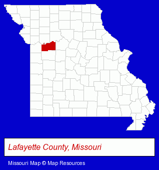
The Missouri counties map at upper right shows Lafayette County, highlighted in red. Use the menu below to display interactive maps of Lexington, either in a frame on this page or in full-screen mode.
Use the menu below to display categorized Lexington directories.
| Lexington Products and Services Directory | |
|---|---|
| Attorneys | Schools |
Selected Lexington, Missouri Listings
These representative Lexington listings provide some insight into the city's cultural environment and economic climate. Lafayette County Health Department- Clinics & Medical Centers
- Clinics
- Schools
- Public Schools
- Colleges & Universities
- Government Contractors
- High Schools
- Schools
- Public Schools
- Colleges & Universities
- Vocational Education
- Industrial & Trade Schools
- Schools
- Public Schools
- Lawn & Garden Equipment & Supplies Retail
- Grain Elevators
Nearby Missouri Cities and Towns *
- Blue Springs (8) - Blue Springs, Missouri demographics and maps.
- Grain Valley (1) - Grain Valley, Missouri information and maps.
- Independence (16) - Independence, Missouri demographics and directory.
- Kansas City (115) - Kansas City, Missouri products & services directory.
- Lees Summit (18) - Lees Summit, Missouri solutions directory and maps.
Large and Mid-size Cities in Nearby States
- Leawood, Kansas (19) - Leawood, KS demographics and directory.
- Kansas City, Kansas (16) - Kansas City, KS demographics and directory.
* Parenthesized numbers indicate economic activity levels.
Copyright © 2011-2026 RegionalDirectory.us. All rights reserved.