Bristol, Rhode Island Map and Directory
Regional Directory > States Menu > Rhode Island
 According to the United States Census Bureau, Bristol is a Town that is located in Bristol County, Rhode Island at 41.68 degrees North and 71.27 degrees West.
The town's time zone is America/New York, and the town's primary telephone area code is 401.
The land area of Bristol is about 9.82 square miles, whereas the water area of the town is about 10.79 square miles.
Bristol County's land area is about 24 square miles, so the town occupies about 40.9 percent of the county's total land area.
According to the United States Census Bureau, Bristol is a Town that is located in Bristol County, Rhode Island at 41.68 degrees North and 71.27 degrees West.
The town's time zone is America/New York, and the town's primary telephone area code is 401.
The land area of Bristol is about 9.82 square miles, whereas the water area of the town is about 10.79 square miles.
Bristol County's land area is about 24 square miles, so the town occupies about 40.9 percent of the county's total land area.
The Census Bureau estimates that Bristol had about 22,145 residents in 2019, which is approximately 2,255 people per square mile of land area.
According to recent American Community Survey data, the median household income in Bristol was about $72,610 per year.
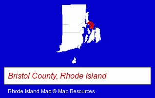
The Rhode Island counties map at upper right shows Bristol County, highlighted in red. Use the menu below to display interactive maps of Bristol, either in a frame on this page or in full-screen mode.
Use the menu below to display categorized Bristol directories.
| Bristol Directory Page: | Ship Building |
|---|
Selected Bristol, Rhode Island Listings
These Bristol listings provide some insight into the town's cultural environment and economic climate.- Industrial Equipment & Supplies Wholesale & Manufacturers
- Industrial Equipment Parts & Accessories Wholesale & Manufacturers
- Cultural Attractions, Events & Facilities
- Tourist Information & Attractions
- Museums
- Marine Professionals & Services
- Ship Building & Repair
- Water Transportation
- Docks
- Boat & Boat Trailer Storage
- Civic Clubs & Organizations
- Sports & Recreation Clubs & Organizations
- Marine Professionals & Services
- Ship Building & Repair
- Physicians & Surgeons
- Alternative Medicine
- Chiropractors
- Alternative Medicine Practitioners
- Marine Professionals & Services
- Water Transportation
- Docks
- Boat Service & Repair
- Steak Restaurants
- Industrial Equipment & Supplies Wholesale & Manufacturers
- Electric Equipment & Supplies Dealers
- Industrial Equipment Parts & Accessories Wholesale & Manufacturers
- Plastic Molders
- Plastic Molds Manufacturers
- Industrial Equipment & Supplies Wholesale & Manufacturers
- Industrial Equipment Parts & Accessories Wholesale & Manufacturers
Nearby Rhode Island Cities and Towns *
- Cranston (9) - Cranston, Rhode Island demographics and directory.
- East Providence (1) - East Providence, Rhode Island information and maps.
- Middletown (3) - Middletown, Rhode Island information and maps.
- Portsmouth (1) - Portsmouth, Rhode Island information and maps.
- Providence (27) - Providence, Rhode Island solutions directory and maps.
- Tiverton (1) - Tiverton, Rhode Island information and maps.
- Warwick (14) - Warwick, Rhode Island demographics and directory.
Large and Mid-size Cities in Nearby States
- Fall River, Massachusetts (10) - Fall River, MA demographics and maps.
* Parenthesized numbers indicate economic activity levels.
Copyright © 2011-2026 RegionalDirectory.us. All rights reserved.