Sedalia, Missouri Map and Directory
Regional Directory > States Menu > Missouri
 According to the United States Census Bureau, Sedalia is a City that is located in Pettis County, Missouri at 38.70 degrees North and 93.23 degrees West.
The city's time zone is America/Chicago, and the city's primary telephone area code is 660.
The land area of Sedalia is about 13.40 square miles, whereas the water area of the city is about 0.02 square miles.
Pettis County's land area is about 682 square miles, so the city occupies about 2.0 percent of the county's total land area.
According to the United States Census Bureau, Sedalia is a City that is located in Pettis County, Missouri at 38.70 degrees North and 93.23 degrees West.
The city's time zone is America/Chicago, and the city's primary telephone area code is 660.
The land area of Sedalia is about 13.40 square miles, whereas the water area of the city is about 0.02 square miles.
Pettis County's land area is about 682 square miles, so the city occupies about 2.0 percent of the county's total land area.
The Census Bureau estimates that Sedalia had about 21,629 residents in 2019, which is approximately 1,614 people per square mile of land area.
According to recent American Community Survey data, the median household income in Sedalia was about $39,804 per year.
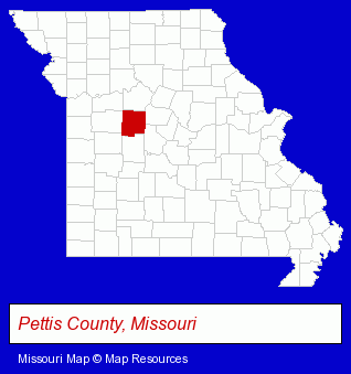
The Missouri counties map at upper right shows Pettis County, highlighted in red. Use the menu below to display interactive maps of Sedalia, either in a frame on this page or in full-screen mode.
Use the menu below to display categorized Sedalia directories.
| Sedalia Products and Services Directory | |
|---|---|
| Attorneys | Radio Stations |
Selected Sedalia, Missouri Listings
These representative Sedalia listings provide some insight into the city's cultural environment and economic climate.- Veterinarians
- Animal Hospitals
- Pet Food & Supplies Retail
- Pet Shops
- Building & Home Construction
- Architectural Services
- Exporters
- Hobbies
- Hobby & Model Stores
- Sign Dealers
- Commercial Signs
- Sign Installation & Hanging
- Electric Signs
- Funeral Services
- Funeral Homes & Directors
- Pre-Arranged Funeral Plans
- Funeral Planning
- Funeral Information & Referral Services
- Medical Testing
- Drug & Alcohol Detection & Testing
- Employment Screening Services
- Sporting Goods Dealers
- Sporting Goods
- Football Clubs & Instruction
- Archery Equipment & Supplies Dealers
- Business Services
- Business Consultants & Advisors
- Management Consultants
- Business Management Services
- Libraries
- Government Contractors
- Water & Sewage Companies
- Water Utility Companies
- Auto Parts Wholesale & Manufacturers
- Florists
- Wedding Equipment & Supplies
- Wedding Supplies & Services
- Churches
- Pentecostal Churches
Nearby Missouri Cities and Towns *
- Blue Springs (8) - Blue Springs, Missouri demographics and maps.
- Columbia (28) - Columbia, Missouri solutions directory and maps.
- Independence (16) - Independence, Missouri demographics and directory.
- Jefferson City (18) - Jefferson City, Missouri solutions directory and maps.
- Lees Summit (18) - Lees Summit, Missouri solutions directory and maps.
- Lexington (2) - Lexington, Missouri information and maps.
- Osage Beach (7) - Osage Beach, Missouri demographics and maps.
* Parenthesized numbers indicate economic activity levels.
Copyright © 2011-2026 RegionalDirectory.us. All rights reserved.